Suport for a TerraLib Raster. More...
#include <TerralibRaster.hh>
Public Member Functions | |
| TerralibRaster () | |
| Empty Constructor. | |
| void | createRaster (const std::string &str, int categ=0) |
| Open an existing raster file or a raster in a TerraLib database (read only). | |
| void | createRaster (const std::string &str, const MapFormat &format) |
| Create a new file for projections. | |
| ~TerralibRaster () | |
| int | get (Coord x, Coord y, Scalar *val) |
| Fills '*val' with the map value at (x,y). | |
| int | put (Coord x, Coord y, Scalar val) |
| Put '*val' at the (x,y) coordinate. | |
| int | put (Coord x, Coord y) |
| Put 'no data val' at the (x,y) coordinate. | |
| int | getMinMax (Scalar *min, Scalar *max) |
| int | deleteRaster () |
Static Public Member Functions | |
| static Raster * | CreateRasterCallback () |
| Return a new instance of TerralibRaster. | |
Private Member Functions | |
| void | openTeRaster () |
| Open an existing TeRaster in a database or file disk. | |
| void | createTeRaster () |
| Create a new TeRaster in a database or file disk. | |
Private Attributes | |
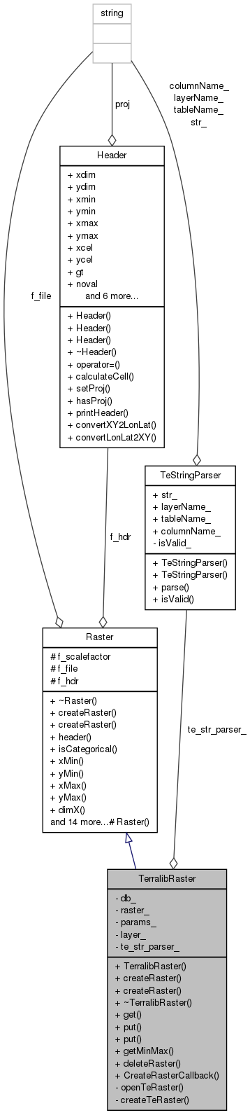
| TeDatabase * | db_ |
| Pointer to database connection. | |
| TeRaster * | raster_ |
| TeRasterParams * | params_ |
| TeLayer * | layer_ |
| TeStringParser * | te_str_parser_ |
| TerraLib DataBase string parser. | |
Detailed Description
Suport for a TerraLib Raster.
Manages raster files with TerraLib http://www.dpi.inpe.br/terralib/index.php .
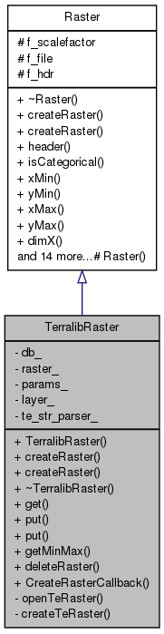
Definition at line 51 of file TerralibRaster.hh.
Constructor & Destructor Documentation
| TerralibRaster::TerralibRaster | ( | ) | [inline] |
Empty Constructor.
RasterFactory need a empty constructor.
Definition at line 64 of file TerralibRaster.hh.
Referenced by CreateRasterCallback().
Destructor
Definition at line 239 of file TerralibRaster.cpp.
References layer_, raster_, and te_str_parser_.
Member Function Documentation
| void TerralibRaster::createRaster | ( | const std::string & | str, |
| int | categ = 0 |
||
| ) | [virtual] |
Open an existing raster file or a raster in a TerraLib database (read only).
- Parameters:
-
str TerraLib string pointing to the raster. categ if != 0 this is a categorical map (ie it can't be interpolated). Othewise this is a continuos map.
Needed by RasterFactory..
Implements Raster.
| void TerralibRaster::createRaster | ( | const std::string & | str, |
| const MapFormat & | format | ||
| ) | [virtual] |
Create a new file for projections.
- Parameters:
-
str TerraLib string pointing to the raster. format It is the output format specification.
Needed by RasterFactory.
Create a new file for projections.
- Parameters:
-
file is the name of the output file format is the output format specification.
Implements Raster.
Definition at line 156 of file TerralibRaster.cpp.
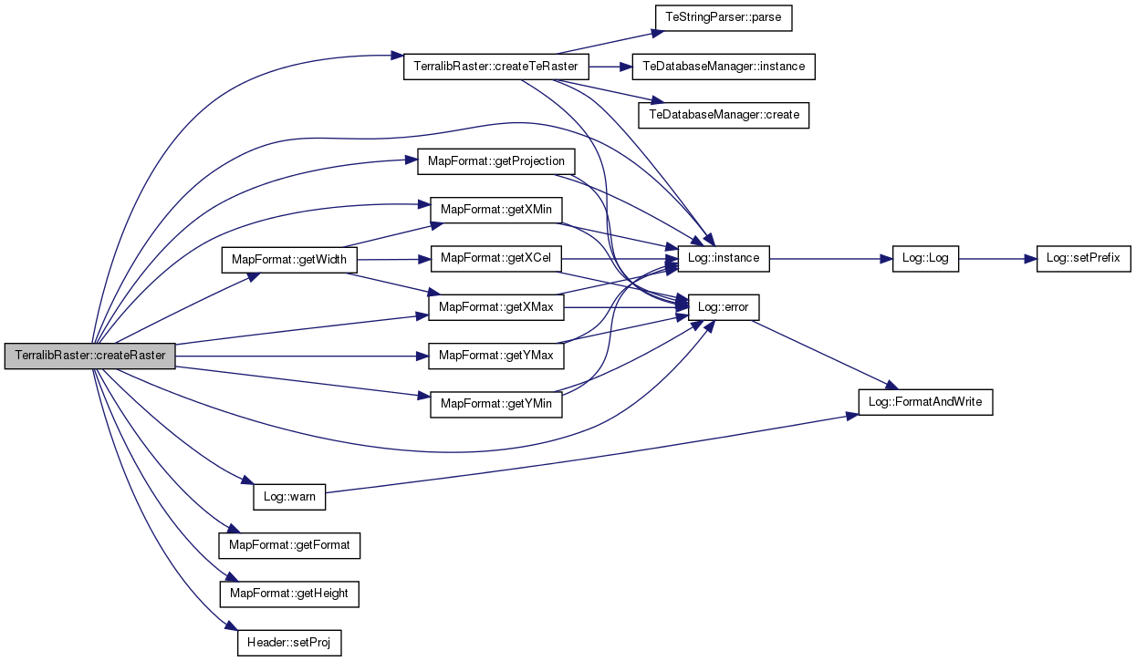
References createTeRaster(), Log::error(), Raster::f_hdr, Raster::f_scalefactor, MapFormat::FloatingTiff, MapFormat::getFormat(), MapFormat::getHeight(), MapFormat::getProjection(), MapFormat::getWidth(), MapFormat::getXMax(), MapFormat::getXMin(), MapFormat::getYMax(), MapFormat::getYMin(), MapFormat::GreyBMP, MapFormat::GreyTiff, Log::instance(), params_, raster_, Header::setProj(), TeStringParser::str_, te_str_parser_, and Log::warn().
| Raster * TerralibRaster::CreateRasterCallback | ( | ) | [static] |
Return a new instance of TerralibRaster.
RasterFactory calls this function to build a new Raster.
Needed by RasterFactory.
Definition at line 61 of file TerralibRaster.cpp.
References TerralibRaster().
Referenced by RasterFactory::instance().

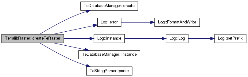
| void TerralibRaster::createTeRaster | ( | ) | [private] |
Create a new TeRaster in a database or file disk.
Definition at line 353 of file TerralibRaster.cpp.
References TeDatabaseManager::create(), db_, Log::error(), Raster::f_hdr, Log::instance(), TeDatabaseManager::instance(), layer_, TeStringParser::layerName_, TeStringParser::parse(), Header::proj, raster_, TeStringParser::str_, and te_str_parser_.
Referenced by createRaster().
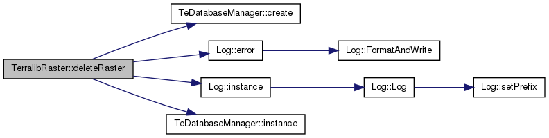
| int TerralibRaster::deleteRaster | ( | ) | [virtual] |
Deletes the associated raster.
- Returns:
- 1 if the raster was successfully deleted, 0 otherwise
Implements Raster.
Definition at line 412 of file TerralibRaster.cpp.
References TeDatabaseManager::create(), db_, Log::error(), Log::instance(), TeDatabaseManager::instance(), layer_, params_, raster_, and te_str_parser_.
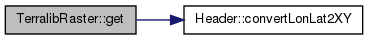
| int TerralibRaster::get | ( | Coord | px, |
| Coord | py, | ||
| Scalar * | val | ||
| ) | [virtual] |
Fills '*val' with the map value at (x,y).
Returns zero if (x,y) is out of range.
Fills '*val' with the map value at (x,y). Returns zero if (x,y) is out of range.
Implements Raster.
Definition at line 254 of file TerralibRaster.cpp.
References Header::convertLonLat2XY(), Raster::f_hdr, raster_, Header::xdim, and Header::ydim.
| int TerralibRaster::getMinMax | ( | Scalar * | min, |
| Scalar * | max | ||
| ) | [virtual] |
Finds the minimum and maximum values in the first band.
- Parameters:
-
min Pointer to minimum value max Pointer to maximum value
- Returns:
- 1 if values are present, 0 otherwise
Implements Raster.
Definition at line 399 of file TerralibRaster.cpp.
References Raster::f_hdr.
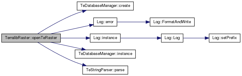
| void TerralibRaster::openTeRaster | ( | ) | [private] |
Open an existing TeRaster in a database or file disk.
Definition at line 319 of file TerralibRaster.cpp.
References TeDatabaseManager::create(), db_, Log::error(), Log::instance(), TeDatabaseManager::instance(), layer_, TeStringParser::layerName_, TeStringParser::parse(), raster_, TeStringParser::str_, and te_str_parser_.
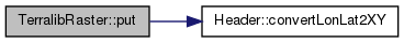
| int TerralibRaster::put | ( | Coord | px, |
| Coord | py, | ||
| Scalar | val | ||
| ) | [virtual] |
Put '*val' at the (x,y) coordinate.
Returns 0 if (x,y) is out of range or the map is read only. supports only single band output files.
Put '*val' at the (x,y) coordinate. Returns 0 if (x,y) is out of range or the map is read only. supports only single band output files.
Implements Raster.
Definition at line 279 of file TerralibRaster.cpp.
References Header::convertLonLat2XY(), Raster::f_hdr, Raster::f_scalefactor, raster_, Header::xdim, and Header::ydim.

| int TerralibRaster::put | ( | Coord | px, |
| Coord | py | ||
| ) | [virtual] |
Put 'no data val' at the (x,y) coordinate.
Returns 0 if (x,y) is out of range or the map is read only. supports only single band output files.
Put 'no data val' at the (x,y) coordinate. Returns 0 if (x,y) is out of range or the map is read only. supports only single band output files.
Implements Raster.
Definition at line 300 of file TerralibRaster.cpp.
References Header::convertLonLat2XY(), Raster::f_hdr, Header::noval, raster_, Header::xdim, and Header::ydim.
Member Data Documentation
TeDatabase* TerralibRaster::db_ [private] |
Pointer to database connection.
TerraLib DataBase Parameters
Definition at line 126 of file TerralibRaster.hh.
Referenced by createTeRaster(), deleteRaster(), and openTeRaster().
TeLayer* TerralibRaster::layer_ [private] |
Definition at line 129 of file TerralibRaster.hh.
Referenced by createTeRaster(), deleteRaster(), openTeRaster(), and ~TerralibRaster().
TeRasterParams* TerralibRaster::params_ [private] |
Definition at line 128 of file TerralibRaster.hh.
Referenced by createRaster(), and deleteRaster().
TeRaster* TerralibRaster::raster_ [private] |
Definition at line 127 of file TerralibRaster.hh.
Referenced by createRaster(), createTeRaster(), deleteRaster(), get(), openTeRaster(), put(), and ~TerralibRaster().
TeStringParser* TerralibRaster::te_str_parser_ [private] |
TerraLib DataBase string parser.
Definition at line 132 of file TerralibRaster.hh.
Referenced by createRaster(), createTeRaster(), deleteRaster(), openTeRaster(), and ~TerralibRaster().
The documentation for this class was generated from the following files: