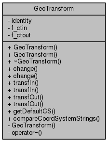
#include <GeoTransform.hh>

Public Member Functions | |
| GeoTransform () | |
| GeoTransform (const std::string &in, const std::string &out) | |
| ~GeoTransform () | |
| void | change (const std::string &in, const std::string &out) |
| void | change () |
| int | transfIn (double *x, double *y) const |
| int | transfIn (double *x, double *y, double x0, double y0) const |
| int | transfOut (double *x, double *y) const |
| int | transfOut (double *x, double *y, double x0, double y0) const |
Static Public Member Functions | |
| static char const * | getDefaultCS () |
| static bool | compareCoordSystemStrings (char const *s1, char const *s2) |
Private Member Functions | |
| GeoTransform (const GeoTransform &) | |
| GeoTransform & | operator= (const GeoTransform &) |
Private Attributes | |
| bool | identity |
| OGRCoordinateTransformation * | f_ctin |
| OGRCoordinateTransformation * | f_ctout |
Detailed Description
Perform geographic transformations between different coordinate systems and projections.
The "source" and "destination" coordinate systems and theirs projections need to be specified using the WKT representation. After that, one can transform points from "source" to "destination" and vice versa.
This class is a wrapper to the OGR library.
- See Also
- http://www.remotesensing.org/gdal/ogr for OGR
- http://gdal.velocet.ca/~warmerda/wktproblems.html for WKT
Definition at line 58 of file GeoTransform.hh.
Constructor & Destructor Documentation
| GeoTransform::GeoTransform | ( | ) |
Definition at line 63 of file GeoTransform.cpp.
| GeoTransform::GeoTransform | ( | const std::string & | in, |
| const std::string & | out | ||
| ) |
| GeoTransform::~GeoTransform | ( | ) |
Definition at line 176 of file GeoTransform.cpp.
|
private |
Member Function Documentation
| void GeoTransform::change | ( | const std::string & | in, |
| const std::string & | out | ||
| ) |
| void GeoTransform::change | ( | ) |
Definition at line 80 of file GeoTransform.cpp.
|
static |
Definition at line 262 of file GeoTransform.cpp.
Referenced by GdalRaster::open().
|
static |
Definition at line 254 of file GeoTransform.cpp.
References OM_WGS84.
Referenced by Garp::cacheSamples(), OccurrencesImpl::initGeoTransform(), Map::Map(), GdalRaster::open(), and OccurrencesImpl::setConfiguration().
|
private |
| int GeoTransform::transfIn | ( | double * | x, |
| double * | y | ||
| ) | const |
Definition at line 188 of file GeoTransform.cpp.
References f_ctin, and identity.
Referenced by Map::get(), OccurrencesImpl::getConfiguration(), Map::getRowColumn(), and Map::put().
| int GeoTransform::transfIn | ( | double * | x, |
| double * | y, | ||
| double | x0, | ||
| double | y0 | ||
| ) | const |
Definition at line 203 of file GeoTransform.cpp.
| int GeoTransform::transfOut | ( | double * | x, |
| double * | y | ||
| ) | const |
Definition at line 222 of file GeoTransform.cpp.
References f_ctout, and identity.
Referenced by OccurrencesImpl::createOccurrence(), Map::getExtent(), and MapIterator::operator*().
| int GeoTransform::transfOut | ( | double * | x, |
| double * | y, | ||
| double | x0, | ||
| double | y0 | ||
| ) | const |
Definition at line 237 of file GeoTransform.cpp.
Member Data Documentation
|
private |
Definition at line 91 of file GeoTransform.hh.
Referenced by change(), transfIn(), and ~GeoTransform().
|
private |
Definition at line 92 of file GeoTransform.hh.
Referenced by change(), transfOut(), and ~GeoTransform().
|
private |
Definition at line 89 of file GeoTransform.hh.
Referenced by change(), transfIn(), and transfOut().
The documentation for this class was generated from the following files:
