#include <WcsProxyRaster.hh>
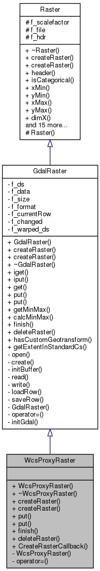
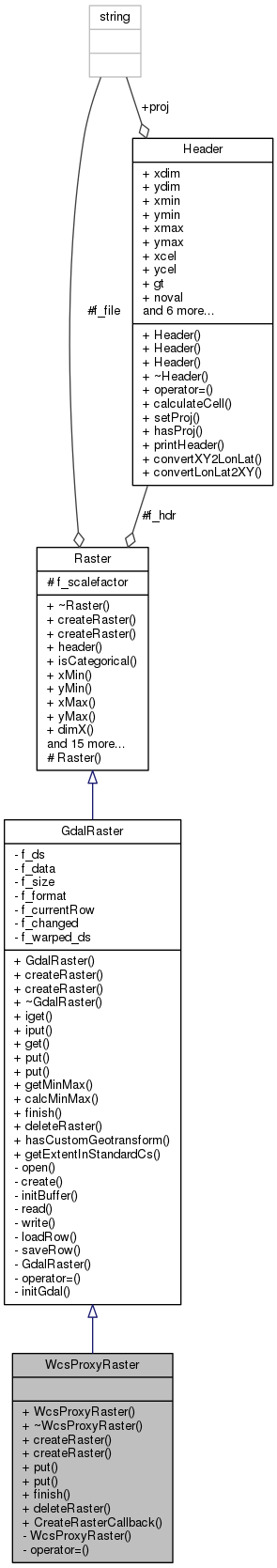
Public Member Functions | |
| WcsProxyRaster () | |
| ~WcsProxyRaster () | |
| void | createRaster (const std::string &str, int categ=0) |
| void | createRaster (const std::string &str, const MapFormat &format) |
| int | put (Coord x, Coord y, Scalar val) |
| int | put (Coord x, Coord y) |
| void | finish () |
| int | deleteRaster () |
 Public Member Functions inherited from GdalRaster Public Member Functions inherited from GdalRaster | |
| GdalRaster () | |
| ~GdalRaster () | |
| int | iget (int x, int y, Scalar *val) |
| int | iput (int x, int y, Scalar val) |
| int | get (Coord x, Coord y, Scalar *val) |
| int | getMinMax (Scalar *min, Scalar *max) |
| int | calcMinMax (int band=0) |
| bool | hasCustomGeotransform () |
| int | getExtentInStandardCs (Coord *xmin, Coord *ymin, Coord *xmax, Coord *ymax) |
| Public Member Functions inherited from Raster | |
| virtual | ~Raster () |
| Header & | header () |
| int | isCategorical () const |
| Coord | xMin () const |
| Coord | yMin () const |
| Coord | xMax () const |
| Coord | yMax () const |
| int | dimX () const |
| int | dimY () const |
| Coord | celX () const |
| Coord | celY () const |
| Scalar | noVal () const |
| int | numBand () const |
| bool | hasMinMax () |
| void | setMinMax (Scalar min, Scalar max) |
Static Public Member Functions | |
| static Raster * | CreateRasterCallback () |
Private Member Functions | |
| WcsProxyRaster (const WcsProxyRaster &) | |
| WcsProxyRaster & | operator= (const WcsProxyRaster &) |
Additional Inherited Members | |
| Protected Member Functions inherited from Raster | |
| Raster () | |
| Protected Attributes inherited from Raster | |
| Scalar | f_scalefactor |
| std::string | f_file |
| Header | f_hdr |
Detailed Description
Translates raster identifiers wcs>wcs url>wcs layer into local XML files compatible with the GDAL WCS format
Definition at line 55 of file WcsProxyRaster.hh.
Constructor & Destructor Documentation
|
inline |
RasterFactory needs an empty constructor.
Definition at line 66 of file WcsProxyRaster.hh.
| WcsProxyRaster::~WcsProxyRaster | ( | ) |
Destructor
Definition at line 132 of file WcsProxyRaster.cpp.
|
private |
Member Function Documentation
|
virtual |
Open a raster (read only). Method needed by RasterFactory.
- Parameters
-
str WCS string pointing to the raster. categ if != 0 this is a categorical map (ie it can't be interpolated). Othewise this is a continuos map.
Needed by RasterFactory.
Reimplemented from GdalRaster.
|
virtual |
Create a new raster for projections. If called will throw an exception since the WCS driver in GDAL does not support creation. Method needed by RasterFactory.
- Parameters
-
str WCS string pointing to the raster. format Output format specification.
Reimplemented from GdalRaster.
|
static |
RasterFactory calls this function to build a new Raster.
Definition at line 139 of file WcsProxyRaster.cpp.
Referenced by RasterFactory::instance().
|
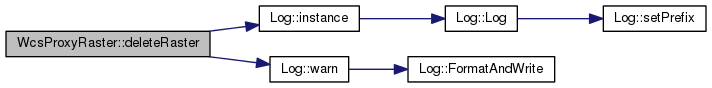
virtual |
Method to delete a raster.
- Returns
- 1 if the raster was successfully deleted, 0 otherwise.
Reimplemented from GdalRaster.
Definition at line 424 of file WcsProxyRaster.cpp.
References Log::instance(), and Log::warn().
|
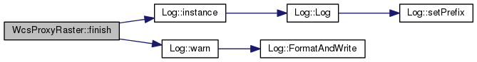
virtual |
Event that must be called to indicate when the projection is finished.
Reimplemented from GdalRaster.
Definition at line 414 of file WcsProxyRaster.cpp.
References Log::instance(), and Log::warn().
|
private |
Put '*val' at the (x,y) coordinate. Returns 0 if (x,y) is out of range or the map is read only. supports only single band output files.
Reimplemented from GdalRaster.
Definition at line 394 of file WcsProxyRaster.cpp.
References Log::instance(), and Log::warn().
Put 'no data val' at the (x,y) coordinate. Returns 0 if (x,y) is out of range or the map is read only. supports only single band output files.
Reimplemented from GdalRaster.
Definition at line 404 of file WcsProxyRaster.cpp.
References Log::instance(), and Log::warn().

The documentation for this class was generated from the following files: